

His ultimate goal was to educate the schoolchildren of Russia with his “optical color projections” of history.

Curated/Reviewed by Matthew A. McIntosh
Public Historian
Brewminate
Introduction
The photographs of Sergei Mikhailovich Prokudin-Gorskii (1863–1944) offer a vivid portrait of a lost world—the Russian Empire on the eve of World War I and the coming revolution. His subjects ranged from the medieval churches and monasteries of old Russia, to the railroads and factories of an emerging industrial power, to the daily life and work of Russia’s diverse population.
In the early 1900s Prokudin-Gorskii formulated an ambitious plan for a photographic survey of the Russian Empire that won the support of Tsar Nicholas II. Between 1909–1912, and again in 1915, he completed surveys of eleven regions, traveling in a specially equipped railroad car provided by the Ministry of Transportation.
Prokudin-Gorskii left Russia in 1918, going first to Norway and England before settling in France. By then, the tsar and his family had been murdered and the empire that Prokudin-Gorskii so carefully documented had been destroyed. His unique images of Russia on the eve of revolution—recorded on glass plates—were purchased by the Library of Congress in 1948 from his heirs. For this exhibition, the glass plates have been scanned and, through an innovative process known as digichromatography, brilliant color images have been produced. This exhibition features a sampling of Prokudin-Gorskii’s historic images produced through the new process; the digital technology that makes these superior color prints possible; and celebrates the fact that for the first time many of these wonderful images are available to the public.
Born in Murom, Vladimir Province, Russia (originally believed to be St. Petersburg) in 1863 and educated as a chemist, Prokudin-Gorskii devoted his career to the advancement of photography. He studied with renowned scientists in St. Petersburg, Berlin, and Paris. His own original research yielded patents for producing color film slides and for projecting color motion pictures. Around 1907 Prokudin-Gorskii envisioned and formulated a plan to use the emerging technological advancements that had been made in color photography to systematically document the Russian Empire. Through such an ambitious project, his ultimate goal was to educate the schoolchildren of Russia with his “optical color projections” of the vast and diverse history, culture, and modernization of the empire. Outfitted with a specially equipped railroad car darkroom provided by Tsar Nicholas II, and in possession of two permits that granted him access to restricted areas and cooperation from the empire’s bureaucracy, Prokudin-Gorskii documented the Russian Empire around 1907 through 1915. He conducted many illustrated lectures of his work. Prokudin-Gorskii left Russia in 1918, after the Russian Revolution, and eventually settled in Paris, where he died in 1944.
Photographer to the Tsar
Expedition to the Urals

Prokudin-Gorskii and members of his photographic team are shown here at their overnight campground. The site is near the Chusovaia River, on the western side of the Ural Mountains which divide Europe from Asia.
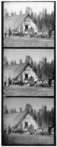
Austro-Hungarian Prisoners of War

In the early years of the First World War, Prokudin-Gorskii photographed a group of prisoners of war from the Austro-Hungarian Empire. The men are probably Poles, Ukrainians, and members of other Slavic nationalities, imprisoned at an unidentified location in the far north of European Russia near the White Sea. This image escaped being confiscated by border guards—the fate of the vast majority of politically sensitive images—when Prokudin-Gorskii left Russia for good in 1918—probably because what is being represented is not immediately obvious.
Glass Plate Negative
Shown here is one of the thousands of glass plate negatives made by Prokudin-Gorskii. The negatives served two purposes. Primarily they were used to produce positive glass slides for his illustrated lectures about the Russian Empire. Prokudin-Gorskii projected the slides through the red, green, and blue filters of a device known as a “magic lantern” which superimposed the images onto a screen resulting in a full-color picture. Secondly, Prokudin-Gorskii used the negatives to print reference photographs of his journeys which were mounted in albums.
Album of Reference Photographs
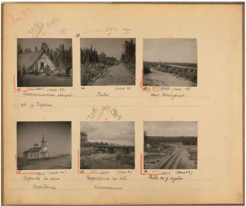
Prokudin-Gorskii created albums to serve as photographic records of his trips across the Russian Empire. Each album is composed of contact prints—created from his glass plate negatives—which were mounted in the order in which he traveled. The album page shown here was created in 1915 during his last known documentary trip.
Architecture
Overview
The architectural richness of the Russian Empire reflected its long history and the cultural, ethnic, and religious diversity of its people. Prokudin-Gorskii photographed medieval churches and monasteries in European Russia and mosques and Islamic schools in the Caucasus and Central Asia. Many of the buildings he photographed were later destroyed by war or revolution, but others survived the Soviet period and have been restored. In addition to religious buildings, Prokudin-Gorskii photographed houses, country estates, factories, and barns. His skill as a photographer and the technical sophistication of his methods are apparent in the treatment of subjects ranging from church interiors to panoramic shots of cities.
Evening View of a Mosque
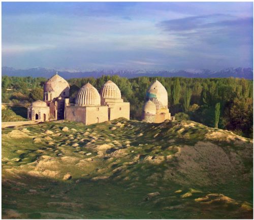
The Pamir Mountains provide a dramatic backdrop for an evening view of the Shakh-i Zindeh Mosque in Samarkand, a complex of graves and mortuary chapels built over many centuries for the women of the dynasties descended from Timur (Tamerlane, 1336-1405), the great medieval ruler of Central Asia.
Study of a Stork’s Nest

A stork, traditionally a symbol of good luck among the Turkic peoples, sits in her nest at the top of a palace wall in Bukhara in Central Asia.
Iconostasis and Miraculous Icon
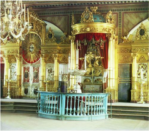
This photograph of the interior of the Church of the Nativity of the Virgin Mary in Smolensk shows the icon screen that in an Orthodox church separates the altar area from the congregation. At the right is a special shrine for the miracle-working icon known as “Odigitria,” traditionally associated with the city of Smolensk.
View of the Nilova Monastery

The Monastery of St. Nil’ on Stolobnyi Island in Lake Seliger in Tver’ Province, northwest of Moscow, illustrates the fate of church institutions during the course of Russian history. St. Nil (d. 1554) established a small monastic settlement on the island around 1528. In the early 1600s his disciples built what was to become one of the largest, wealthiest, monasteries in the Russian Empire. The monastery was closed by the Soviet regime in 1927, and the structure was used for various secular purposes, including a concentration camp and orphanage. In 1990 the property was returned to the Russian Orthodox Church and is now a functioning monastic community once more.
Church of St. Dmitrii

The Church of St. Dmitrii, built in the 1190s in the town of Vladimir, east of Moscow in central European Russia, illustrates the verticality common to early Russian church architecture. This church served as the model for the Cathedral of St. Nicholas of the Orthodox Church of America on Massachusetts Avenue, in Washington, D.C.
View of the Solovetskii Monastery

The Solovetskii Monastery, founded in the early fifteenth century on an island in the White Sea in the far north of European Russia, was for centuries one of the most important monastic and cultural institutions in Russia. The thick walls shown in this photo protected the monastery from foreign invaders on several occasions. The monastery was partially destroyed in the early Soviet period and became the site of the first major concentration camp of the Gulag system. In the post-Soviet era it was returned to the Orthodox Church and is once again a functioning monastery.
Tiled Porcelain Stove in the Prince’s Palace

This photograph of the interior of the Prince’s Palace shows a ceramic tile heating stove surrounded by brightly painted furnishings and walls with decorative frescoes. The palace was built in the fifteenth century in Rostov the Great, an old Russian town northeast of Moscow.
Church of the Resurrection
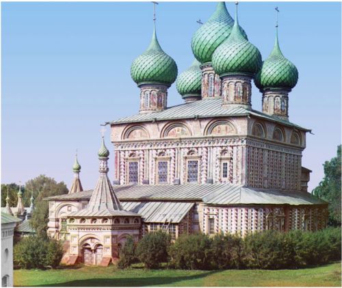
Russian churches featured exterior and interior decoration in the forms of mosaics, frescoes, and carvings, often in brilliant colors. The Church of the Resurrection in Kostroma in the northern part of European Russia was built in the 1650s and demonstrates the exuberant decoration of the exterior characteristic of its period. However, in spite of the dramatic exterior, the church is noted primarily for its interior wall paintings.
Cathedral of the Nativity of the Virgin
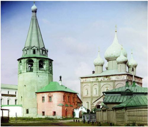
The Cathedral of the Nativity of the Virgin is the oldest church building in Suzdal’. It is located in the Suzdal’ kremlin, the original walled, fortress-like part of the city. The cathedral, which dates to the twelfth century, was rebuilt many times over the years and displays the onion domes so characteristic of Russian church architecture.
Portion of the Shir-Dar Madrasa
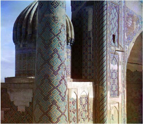
The tiled columns, walls, and domes of the Shir-Dar (“Lions’ House”) madrasa in Samarkand show the elaborate abstract designs and use of calligraphy typical in much of Islamic and Central Asian architecture. This madrasa, constructed 1619-1636 and in essence a Muslim theological academy and school, is part of the complex of mosques and madrasas found in Registan, the most sacred precinct of old Samarkand.
Church of the Nativity of the Virgin
Founded around 1330, the Trinity-Ipat’ev Monastery in the old Russian Volga River city of Kostroma, northeast of Moscow, contained within its walls several old churches, including the Church of the Nativity of Virgin the shown here. Originally constructed in the sixteenth century, the church was demolished in the early Soviet period. This photograph may be the only color photograph ever taken of the church.
View of Tobol’sk from the Bell Tower of the Church of the Transfiguration
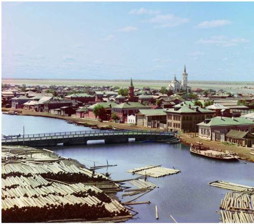
From the time of its founding in 1587 until the late 1800s, Tobol’sk was one of the largest and most important cities in Siberia. For several centuries Tobol’sk served as the military, administrative, and political center of Russian rule in Siberia. This panoramic view shows the Irtysh River in the foreground and the broad, flat Siberian plain beyond the central part of the city.
Cathedral of St. Nicholas, Mozhaisk
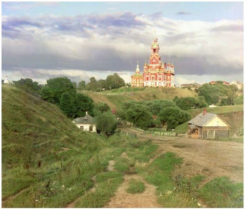
A dirt road leads to the brightly painted seventeenth-century Cathedral of St. Nicholas amid modest residential structures in Mozhaisk, west of Moscow.
View of Tiflis
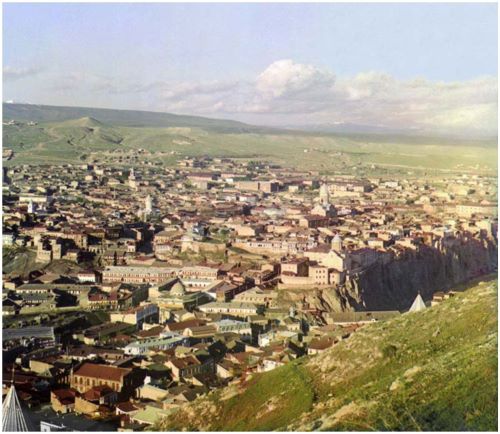
This panoramic view of Tiflis shows the city nestled in a valley amid ridges in the Caucasus Mountains. The city today is Tbilisi, the capital of the now independent Republic of Georgia. At the time this photograph was taken, around 1910, the city had a multinational population of 160,000, including Georgians, Armenians, Russians, Persians, Poles, Tatars, and Jews.
View of the Likanskii Palace from the Kura River
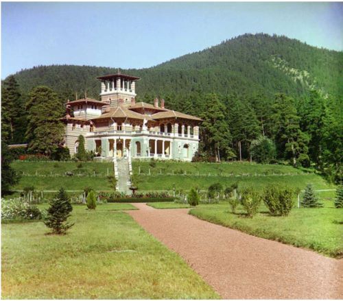
The Likany foothills of the Caucasus Mountains provide a dramatic backdrop for a palace built on the Kura River, close to the Russian border with Turkey and near the town of Borzhomi in present-day Georgia.
Wooden Chapel on the Site of Old Belozersk
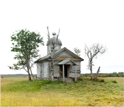
First mentioned in Russian chronicles for the year 862 A.D., the town of Belozersk or “White Lake” was abandoned and relocated several times. The original settlement, commemorated here by a small nineteenth-century wooden chapel, was on the north side of the White Lake in north central European Russia.
Storage Facilities for Hay
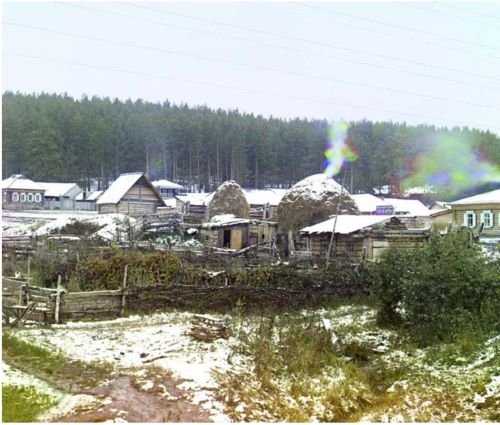
In the settlement of Viazovaia, along the Trans-Siberian mainline in the Ural Mountain region, wooden storage facilities for hay and food crops are photographed against the background of a dense pine forest.
View of Suzdal’ from the Kamenka River

Stone churches, wooden houses, and a small bridge over the Kamenka River are photographed at the edge of the ancient Russian town of Suzdal’, northeast of Moscow. Once an important and powerful principality, Suzdal’ declined as Moscow rose in prominence and consolidated control over several principalities in central European Russia.
The Village of Kolchedan

A dirt road passing over a stone bridge leads to the small town of Kolchedan in the Ural Mountains, southeast of Ekaterinburg. Originally founded in 1673 as a frontier stockade, by the time this photo was taken in 1912, the town was a center for sandstone mining and processing and had two substantial stone church buildings, including a convent with a school.
Ethnic Diversity
Overview
The Russia of Nicholas II on the eve of World War I was a land of striking ethnic diversity. Comprising all of the republics of what later was to become the Soviet Union, as well as present-day Finland and much of Poland, Russia was home to more than 150 million people—of which only about half were ethnic Russians. In his travels throughout the empire, Prokudin-Gorskii captured this diversity. His color photographs of peasants from rural Russia, the nomadic peoples of Central Asia, and the mountain peoples of the Caucasus predate the forced Russification and the rapid modernization of the Soviet period and document traditional costumes and ways of life.
Russian Peasant Girls
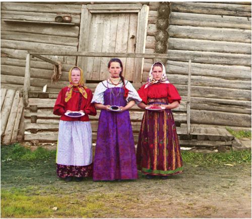
Young Russian peasant women offer berries to visitors to their izba, a traditional wooden house, in a rural area along the Sheksna River near the small town of Kirillov.
The Emir of Bukhara
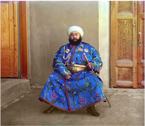
The Emir of Bukhara, Alim Khan (1880-1944), poses solemnly for his portrait, taken in 1911 shortly after his accession. As ruler of an autonomous city-state in Islamic Central Asia, the Emir presided over the internal affairs of his emirate as absolute monarch, although since the mid-1800s Bukhara had been a vassal state of the Russian Empire. With the establishment of Soviet power in Bukhara in 1920, the Emir fled to Afghanistan where he died in 1944.
Nomadic Kazakhs on the Steppe
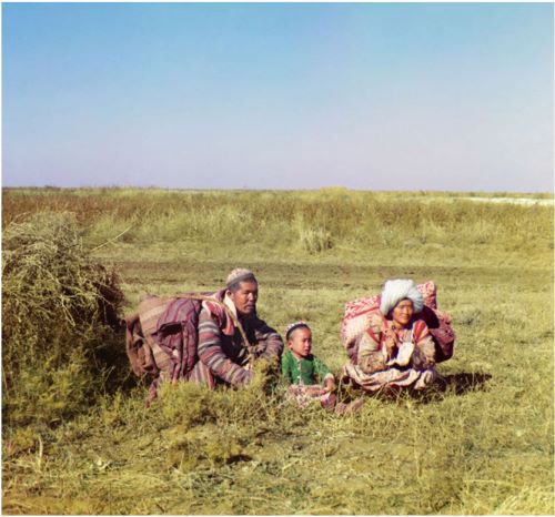
Many Central Asiatic peoples, for example the Kirghiz, Kazakhs, and Uzbeks, lived nomadic lives on the steppes, valleys, and deserts, migrating seasonally from one place to another as opportunities for obtaining food, water, and shelter changed. Shown here is a young Kazakh family in colorful traditional dress moving across the Golodnaia (or “Hungry”) steppe in present-day Uzbekistan and Kazakhstan.
Jewish Children with their Teacher

Samarkand, an ancient commercial, intellectual, and spiritual center on the Silk Road from Europe to China, developed a remarkably diverse population, including Tajiks, Persians, Uzbeks, Arabs, Jews, and Russians. Samarkand, and all of West Turkestan, was incorporated into the Russian Empire in the middle of the nineteenth century and has retained its ethnic diversity up to the present. Prokudin-Gorskii captures here a group of Jewish boys, in traditional dress, studying with their teacher.
Profile of a Nomad
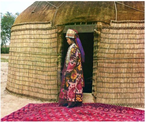
In this portrait, Prokudin-Gorksii captures the traditional dress, jewelry, and hairstyle of an Uzbek woman standing on a richly decorated carpet at the entrance to a yurt, a portable tent used for housing by the nomadic peoples of Central Asia. After conquering Turkestan in the mid 1800s, the Russian government exerted strong pressure on the nomadic peoples to adopt a sedentary lifestyle and settle permanently in villages, towns, and cities.
Prisoners in a Zindan with Guard

Five inmates stare out from a zindan, a traditional Central Asian prison–in essence a pit in the earth with a low structure built on top. The guard, with Russian rifle and bayonet, is attired in Russian-style uniform and boots.
Portrait of a Dagestani Couple
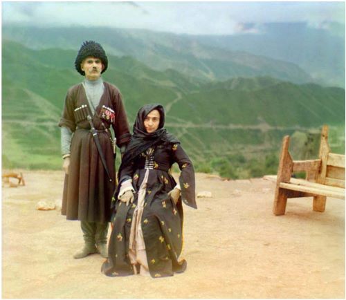
A couple in traditional dress poses for a portrait in the mountainous interior region of Gunib on the north slope of the Caucasus Mountains in what is today the Dagestan Republic of the Russian Federation.
Chinese Foreman at the Chakva Tea Farm
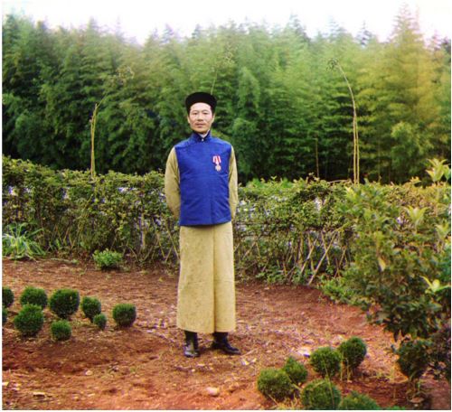
A Chinese foreman poses with established tea plants and new plantings at a tea farm and processing plant in Chakva, a small town just north of Batumi. The semi-tropical climate of the Black Sea coast in modern-day Georgia was ideal for growing tea.
Study of a Dagestani Man

Dagestan, meaning “land of mountains” in the Turkic languages, contains a population consisting of many nationalities, including Avars, Lezgi, Noghay, Kumuck, and Tabasarans. Pictured here is a Sunni Muslim man of undetermined nationality wearing traditional dress and headgear, with a sheathed dagger at his side.
Russian Children on a Hillside
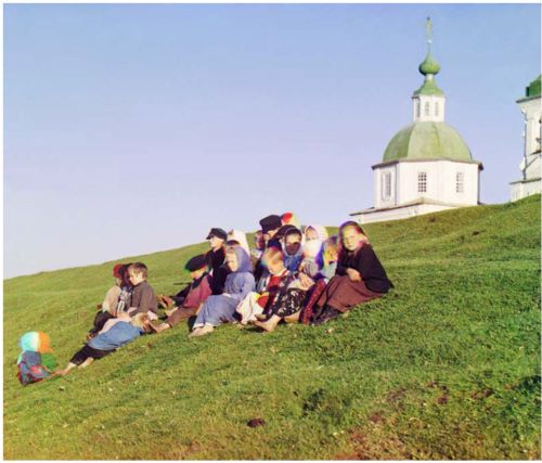
Children sit on the side of a hill near a church and bell-tower in the countryside near White Lake, in the north of European Russia.
Russian Settlers in the Borderlands

Ethnic Russian settlers to the Mugan Steppe region, south of the Caucasus Mountains and west of the Caspian Sea, established a small settlement named Grafovka. The region is immediately north of the border with Persia. Settlement of Russians in non-European parts of the empire, and particularly in border regions, was encouraged by official government policy and accounts for much of the Russian migration to Siberia, the Far East, and the Caucasus regions.
Transportation
Overview
Prokudin-Gorskii’s many photographs of railroad bridges, locomotives, barges, steamers and canals reflect the importance of the transportation system in tying together the vast Russian Empire. The Ministry of Transport operated a network of railroads and steamers, but private companies were also involved in rail, river, and canal transport.
The Ministry of Transport facilitated many of Prokudin-Gorskii’s survey trips, beginning in 1909. His first trip was to survey the Mariinskii Canal system linking the upper Volga and Neva rivers. He photographed bridges, dams, locks, and steamers as well as the people who operated the system. On subsequent trips, Prokudin-Gorskii documented the achievements of Russian engineers in extending the railroads across the rugged terrain of the Urals and into Siberia. Prokudin-Gorskii undertook his last assignment for the ministry during World War I, when he photographed the construction of the Murmansk Railway, which was built as a supply link between Russia and its French and British allies.
Handcar on the Murmansk Railroad
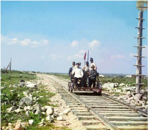
Prokudin-Gorskii and others ride the Murmansk Railroad in a handcar along the shores of Lake Onega near Petrozavodsk. From the beginning of Russian railroad construction in the 1850s, rails were laid using a wider gauge (5 feet 3.5 inches) than the standard European one.
Portrait of Pinkhus Karlinsky, 84 Years Old

Pinkhus Karlinskii, the supervisor of the Chernigov floodgate, stands by a ferry dock along the Mariinskii Canal system in the northern part of European Russia. In the photo album of his tour of the canal system, Prokudin-Gorskii noted that Karlinskii was eighty-four years old and had served for sixty-six years. The canal system, known today as the Volga-Baltic Waterway, was constructed to link the extensive river system of the Volga and its tributaries to provide access from the interior of European Russia to the Baltic Sea.
Metal Truss Railroad Bridge

This Trans-Siberian Railway metal truss bridge, on stone piers, spans the Kama River near Perm in the Ural Mountains Region. The rivers were only one of the natural barriers that the builders of the Trans-Siberian Railway had to conquer in the feat of constructing a railroad over 6,000 miles, from central European Russia eastward to the Pacific Ocean.
Kareshka Boat Yards
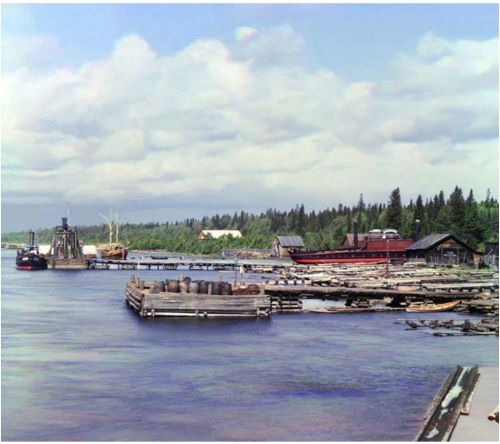
A variety of canal boats and barges, large and small, are evident at a boat yard at a sheltered inlet off the southwest shore of Lake Onega on the Mariinskii canal system near the small town of Voznesenie in the north of European Russia.
Log Rafts on the Peter I Canal, Shlisselburg

Logs fastened together as rafts make their way down the Peter I Canal near the small town of Shlisselburg, now called Petrokrepost’. Located on Lake Ladoga, the town is forty miles east of St. Petersburg.
Locomotive
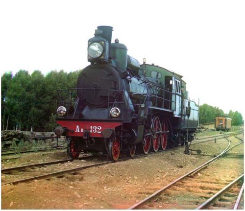
A “Compound” locomotive with a Schmidt boiler is shown on the railroad between Perm’ and Ekaterinburg in the Ural Mountain region in the far eastern part of European Russia. The rail car in the background is thought to be Prokudin-Gorskii’s traveling photographic laboratory and living quarters.
Towpath Bridge in the Village of Lava
A stone bridge carries the canal towpath over two culverts to divert high water away from the main canal on a quiet stretch between Lakes Ladoga and Onega near the village of Lava.
Bashkir Switchman on the Trans-Siberian
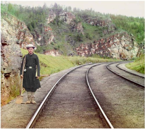
A Bashkir switch operator poses by the mainline of the railroad, near the town of Ust’ Katav on the Yuryuzan River between Ufa and Cheliabinsk in the Ural Mountain region of European Russia.
People at Work
Overview
By the eve of World War I, Russia had undergone rapid industrial development, much of it fueled by foreign investment and the import of technology from Western Europe. Key industries included textiles, metal-working, and chemical and oil production. At the same time, many people lived in appallingly backward conditions, especially in the countryside.
Prokudin-Gorskii documented the economic life of the empire in all its variety. He photographed farmers cultivating fields and the production of grain in the temperate regions of European Russia; the harvesting of cotton, tea, and other crops in the warmer regions of the south; artisans in small shops; and large new factories equipped with the newest Russian and imported machines. Economic conditions in these same areas drastically worsened during World War I, contributing to the growth of revolutionary movements and ultimately the overthrow of the tsar and the destruction of the empire.
Windmills in Ialutorovsk County
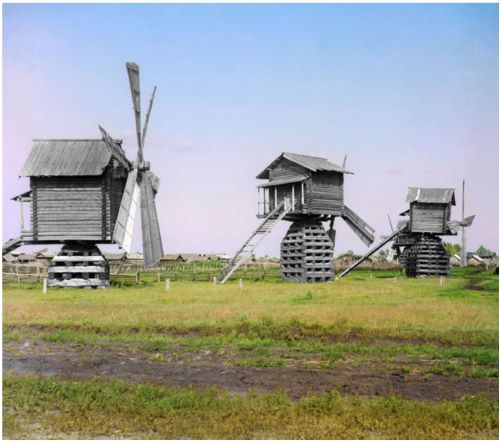
Wooden mills using wind-power to grind wheat and rye are photographed in the middle of summer on the vast Siberian plain in rural Ialutorovsk county in Western Siberia.
Study of Three Generations, Zlatoust
A. P. Kalganov poses with his son and granddaughter for a portrait in the industrial town of Zlatoust in the Ural Mountain region of Russia. The son and granddaughter are employed at the Zlatoust Arms Plant—a major supplier of armaments to the Russian military since the early 1800s. Kalganov displays traditional Russian dress and beard styles, while the two younger generations have more Westernized, modern dress and hair styles.
Turkmen Camel Driver

Wearing traditional dress and headgear, a Turkmen camel driver poses with his camel, laden with what is most likely grain or cotton. Camel caravans remained the most common means of transporting food, raw materials, and manufactured goods in Central Asia well into the railroad era.
Tea Weighing Station
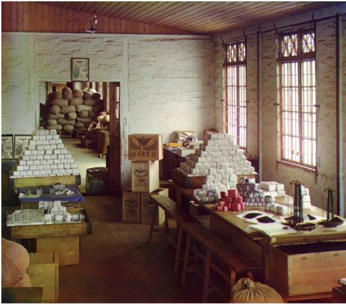
This photo shows the interior of a tea packaging and weighing operation located at the Chakva tea farm and processing plant just north of Batumi, close to the Black Sea coast in what is now the Republic of Georgia. The Chakva farm and plant was one of the major suppliers of tea to all parts of the Russian Empire.
Melon Vendor

Dressed in traditional Central Asian attire, a vendor of locally grown melons poses at his stand in the marketplace of Samarkand in present-day Uzbekistan.
Fabric Merchant
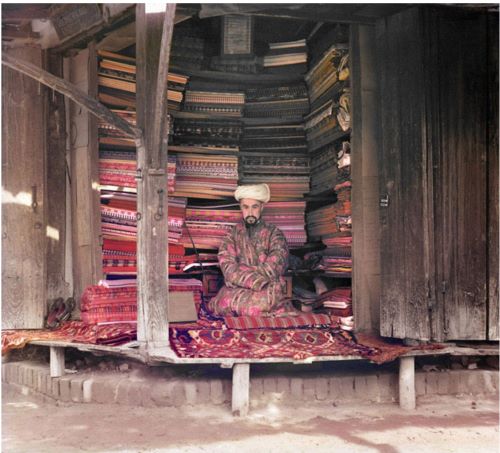
A merchant at the Samarkand market displays colorful silk, cotton, and wool fabrics as well as a few traditional carpets. A framed page of the Koran hangs at the top of the stall.
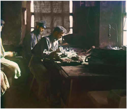
Factory Interior with Electrical Generators
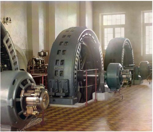
In his quest to record the development of the empire, Prokudin-Gorskii photographed this unidentified industrial factory interior with large electrical generators. The generators in this photograph have markings that indicate they were manufactured in Budapest, Hungary.
Textile Mill Interior
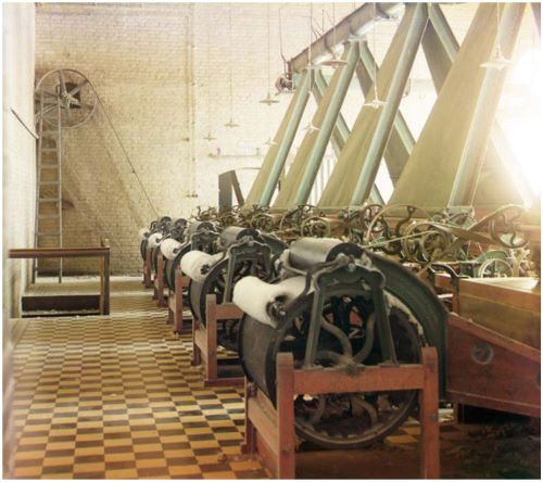
Shown here is the interior of a textile mill that produces thread from locally grown cotton. The location, though unidentified, is most likely in Tashkent which is known for textile production. Because of the warm, dry climate, Central Asia—and particularly Uzbekistan—was an ideal location for growing and processing cotton for the entire empire.
Production of Artistic Casting
Founded in 1747, the Kasli Iron Works, was located in the heart of the Ural Mountains between the cities of Ekaterinburg and Cheliabinsk—a region rich in iron ore. The plant was known for the high quality of its cast iron products and for its highly-skilled work force, which numbered over three thousand persons at the time this photograph was taken.
Harvesting Tea
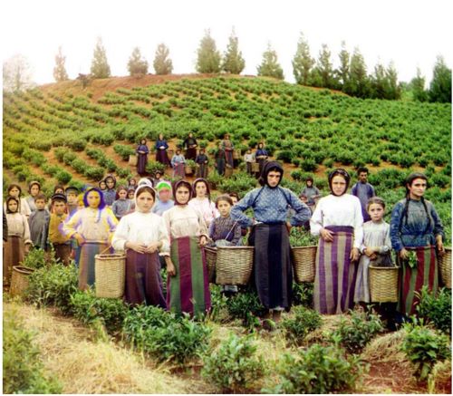
Workers, identified by Prokudin-Gorskii as Greeks, pose while harvesting tea from plants spreading over rolling hills near Chakva, on the east coast of the Black Sea. This region of the Russian Empire, in present day Ukraine, Moldova, and Georgia, had a significant Greek minority, some families going back many centuries to the Classical and Byzantine eras.
Cotton Field in Sukhumi Botanical Garden
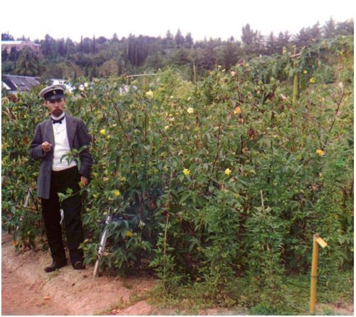
The moderate, Mediterranean-like climate of the Black Sea region allowed cultivation of crops that would not grow in most parts of the empire, such as tea and cotton. Sukhumi, on the east coast of the Black Sea in what is now the northwestern part of the Republic of Georgia, had an important botanical garden and experimentation station. Shown here is a stand of cotton plants at the Sukhumi Botanical Gardens.
The Bakalskii Mine
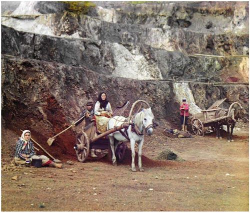
The Ural Mountain region is noted for the richness of its iron deposits and ores. The Bakaly hills, in the area outside the city of Ekaterinburg, provide the locale for a small-scale family mining operation.
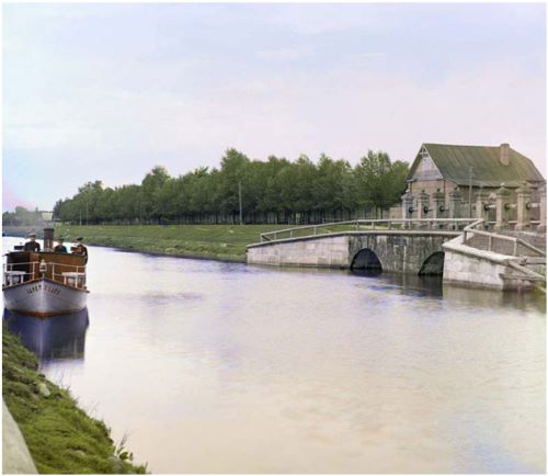
Cementing the Foundation of a Sluice Dam
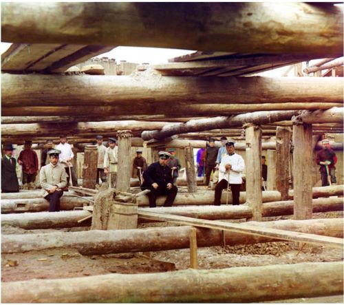
Workers and supervisors pause for a photograph amid preparations for pouring cement foundations for a sluice dam across the Oka River southeast of Moscow, near the small town of Dedinovo.
Tajik Man
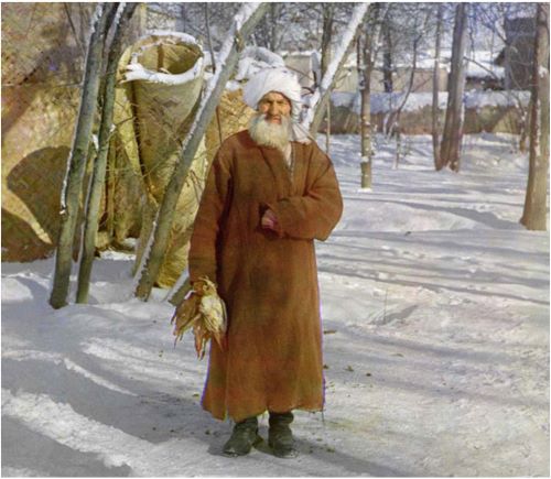
In a photograph taken near Samarkand, an old man, probably an ethnic Tajik, holds birds he has just caught. Samarkand and its region were noted for wide diversity in ethnic groups, including Uzbeks, Tajiks, Persians, and Arabs as well as the more recently arrived Russians.
Monks at Work Planting Potatoes

Monks wearing traditional habits plant potatoes in fields reclaimed from the dense conifer forest at the Gethsemane Hermitage on Lake Seliger near the headwaters of the Volga River.
Hay Harvest
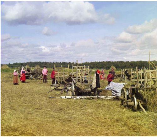
An early autumn scene from 1909 shows farmers taking a short break from their work to pose for their photograph. The location, though unidentified, is probably near the town of Cherepovets in north central European Russia.
Ekaterinin Spring

Borzhomi is a small town in the Caucasus Mountains in the interior of what is now the Republic of Georgia. Noted for its mineral waters, it was a fashionable spa at the end of the nineteenth century. Shown here are elegantly dressed visitors posing for a photograph by the Ekaterinin, (“Catherine’s”) Spring.
Agricultural Fields Near Samarkand
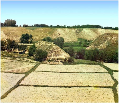
The city of Samarkand was surrounded by oases and agricultural regions that supported the urban population. Traditional food crops grown on fields such as these included melons, wheat, beans, rice, and barley.
Originally published by the United States Library of Congress to the public domain.