
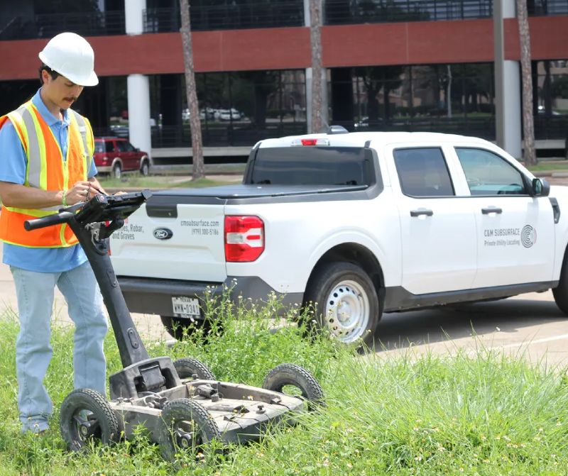
Before excavation begins, crews need a reliable picture of what lies beneath the surface. Buried water lines, electrical conduits, communication cables, and abandoned structures can sit outside old records or shift from expected paths. Ground-penetrating radar sends electromagnetic pulses into the ground and records the returning signals that reveal subsurface boundaries. The method reduces unnecessary digging and gives project teams better information for planning. The scanning process explains how those results guide safer utility work.
For projects in developed areas, existing plans rarely show every buried line or abandoned feature. Pavement, landscaping, and compacted soil can conceal hazards that excavation crews cannot see from the surface. A Dallas, TX, ground-penetrating radar survey gives contractors non-invasive subsurface data before equipment breaks ground. The information supports utility locating, concrete scanning, infrastructure work, and site planning without removing the surface.
What Ground Penetrating Radar Detects
Ground-penetrating radar transmits short electromagnetic pulses into the ground via an antenna. When those pulses encounter a change in material, part of the energy is reflected back to the antenna. The system records the returning signal and builds a profile that shows reflections beneath the scan path.
Different materials produce different signal responses. Metal utilities usually produce strong reflections, while plastic pipes can appear as changes in the surrounding soil or in their contents. Voids, disturbed soil, concrete, rebar, and buried debris also create detectable boundaries.
Establishing the Scan Area
A locating crew first reviews the proposed excavation area, available utility records, and site conditions. The team then marks a scan grid or follows the planned trench, bore path, or foundation footprint. This organized coverage prevents gaps between individual passes.
Surface conditions affect the survey. Dense vegetation, standing water, rough ground, heavy traffic, and reinforced pavement can limit antenna movement or create signal interference. The crew records these conditions while collecting the data.
Collecting and Reading Signals
The operator moves the antenna across the ground at a controlled pace. The system records signal strength and depth relationships along each path, producing radar profiles for review during the scan. A utility often appears as a curved reflection when the antenna crosses it. Repeated passes from different directions help locate the feature’s position and estimate its path. The operator compares reflections across the grid rather than relying on a single isolated signal.
Depth estimates depend on the ground’s electrical properties. Moisture, clay, fill material, and surface construction affect signal travel and image quality. For that reason, radar results require trained interpretation rather than automatic acceptance of every visible pattern.
Why Does Electromagnetic Locating Support GPR?
Ground-penetrating radar images subsurface changes, but it does not identify every buried line by material alone. Electromagnetic locating adds another method for tracing conductive utilities, such as metallic pipes, electrical cables, and tracer-wire-equipped plastic lines.
The operator applies or detects a signal and follows its response along the utility route. Comparing electromagnetic findings with radar reflections improves confidence in the marked location. This combined approach also helps distinguish a continuous utility from isolated buried debris.
No locating method replaces careful excavation practices. Records, surface indicators, electromagnetic findings, and GPR data should be reviewed together before digging begins. Crews should treat marked locations as planning information and use controlled excavation near suspected utilities.
What Happens After Scanning
The crew marks detected features on the ground using paint, flags, or other site-approved methods. Markings show the estimated route and help equipment operators maintain clearance during excavation. The team also records scan paths, signal observations, and areas that require further review.
Project managers can then adjust trench locations, plan hand excavation, or coordinate utility verification before heavy equipment enters the area. Early findings also support decisions about boring routes, foundations, drainage work, and concrete cutting.
GPR data does not replace utility ownership records or required notification procedures. It gives the project team another source of site information before breaking ground. A complete plan combines those records with field locating and safe excavation controls.
Conclusion
Ground-penetrating radar locates buried utilities by sending electromagnetic pulses beneath the surface and recording reflections from changes in material properties. Operators interpret those reflections across a planned scan area, then compare them with electromagnetic locating results and site records. The process gives crews a clearer basis for marking hazards and choosing excavation methods. Before scheduling a dig, project managers should arrange a subsurface survey early enough to review findings, mark routes, and revise work plans where needed.
About the Author