In 1362, the Grote Mandrenke drowned Rungholt beneath the North Sea. The storm was natural, but generations of peat cutting, drainage, and reclamation helped make the disaster permanent.

By Matthew A. McIntosh
Public Historian
Brewminate
Introduction: The City Beneath the Tide
Beneath the tidal flats of the North Frisian Wadden Sea lies one of medieval Europe’s most haunting disaster landscapes. Rungholt, remembered for centuries as a drowned town swallowed by the North Sea, has often been treated as half-history and half-legend: a wealthy settlement, a sinful city, a lost port whose church bells could still be heard beneath the water on quiet nights. Yet modern geoarchaeology has brought Rungholt out of folklore and back into the material world. Geophysical surveys, sediment cores, magnetic mapping, and the identification of settlement remains around Hallig Südfall have revealed not simply the memory of a vanished place, but the physical traces of a medieval cultural landscape destroyed during the great storm surge of January 1362. The discovery of what appears to have been Rungholt’s major church has sharpened that picture further, showing that this was not merely a scattered marsh settlement but a socially organized, economically significant, and ecclesiastically visible community.
The disaster that destroyed Rungholt is known as the Grote Mandrenke, the “Great Drowning of Men,” or the Second Saint Marcellus Flood. Striking the southern North Sea coast around January 15–16, 1362, it devastated parts of the British Isles, the Low Countries, northern Germany, and Denmark. Medieval and later traditions assigned enormous death tolls to the storm, often around 25,000 people or more, and described the loss of villages, parishes, fields, dikes, and whole districts of coastal land. In North Frisia, the event became more than a flood. It marked the conversion of cultivated marshland into tidal flats, the rupture of a human-made coastal order, and the transformation of Rungholt from a living place into a warning story. The sea did not merely enter the town and withdraw. It remade the landscape so completely that later generations had to search for Rungholt in mud, memory, and myth.
The drowning of Rungholt should not be understood as a purely natural catastrophe, even though the storm itself was a natural meteorological event. The North Sea supplied the gale, the surge, and the destructive force, but generations of human land use had prepared the conditions that made the disaster so severe and so permanent. Medieval inhabitants of the North Frisian coast diked marshes, drained wetlands, cut peat, reclaimed land, and converted amphibious environments into fields, settlements, and trade corridors. These were rational and often successful choices in the short term. They produced fertile soils, fuel, salt, pasture, and wealth, and they allowed communities such as Rungholt to participate in the wider commercial and ecclesiastical world of the medieval North Sea. But those gains came from a landscape whose stability depended on height, saturation, and flexibility. Peatlands and marshes were not empty wastelands waiting to be improved; they were protective structures formed over centuries, storing water, absorbing tidal energy, and preserving elevation in a zone where small changes in ground level could determine whether land remained habitable or became sea. Drainage dried and compacted organic soils. Peat cutting physically removed mass from the ground. Dikes and embankments interrupted the natural movement of water and sediment, creating productive enclosed land while also preventing the regular processes that had helped marsh surfaces adjust to tidal conditions. This made the reclaimed coast more artificial, more profitable, and more fragile. Rungholt’s tragedy was that prosperity itself had been built into a sinking landscape, and the community’s confidence in its engineered world may have concealed the extent to which its margin of safety had already been consumed.
The story begins before the night of the flood. It begins with the gradual transformation of a wetland edge into a medieval economic zone, with the confidence that dikes and drainage could make the coast stable, and with the slow removal of the very materials that had given the marshland height and resilience. Later legend imagined Rungholt as a place punished for pride or impiety. Modern evidence suggests a different kind of warning. The people of Rungholt were not destroyed because they offended heaven; they were destroyed because a dangerous sea met a landscape whose own protections had been reduced, rearranged, and consumed. Saint Marcellus’ Flood was remembered as divine judgment, but its deeper history is environmental: a storm became a disaster because human beings had already lowered the ground beneath their feet.
An Amphibious World: The Wadden Sea Before Reclamation
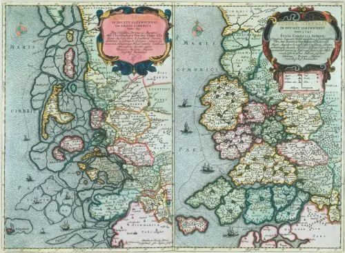
Before Rungholt became a drowned city, and before the North Frisian marshes became a medieval cultural landscape of dikes, fields, churches, and trading settlements, the Wadden Sea was an amphibious world. It was neither stable land nor open sea, but a shifting coastal zone where tidal flats, salt marshes, peat bogs, creeks, barrier islands, storm channels, and shallow basins continually remade one another. The sea advanced and withdrew with the tides; sediment accumulated in some places and vanished in others; marsh surfaces rose slowly where plants trapped silt, while exposed flats could be cut away by currents and storms. To later settlers, this environment offered possibility. It contained pasture, fish, birds, reeds, salt, fuel, and eventually arable land. But those possibilities existed inside a landscape whose basic condition was instability.
The Wadden Sea had been shaped over millennia by Holocene sea-level rise and by the interaction between water, sediment, vegetation, and older geological surfaces. Along the Schleswig-Holstein coast, the sea did not simply cover a flat plain. It entered a varied postglacial landscape, filled depressions, reworked older deposits, and produced new coastal forms. Marshes developed where sedimentation and vegetation could keep pace with tidal influence. Peat formed where waterlogged conditions slowed decomposition and allowed organic matter to accumulate. Channels cut through these surfaces, carrying tidal water deep into the coastal lowlands and then draining them again. The result was a coast of thresholds: slightly higher natural levees, lower boggy interiors, salt marsh margins, tidal flats, and shallow waters, all separated by differences of elevation that could be measured in small increments but meant everything for human habitation.
This mattered because the pre-reclamation landscape possessed forms of natural protection that were easy to misunderstand. Peat bogs and marshes were not hard barriers like stone walls, but they created height, absorbed water, slowed flow, and stored the history of centuries of accumulation. They worked by volume, saturation, and resistance rather than by visible force. A thick peat surface could hold water like a sponge while keeping the ground raised above surrounding flats; a marsh edge could receive tidal water without immediately surrendering the land behind it; a branching network of creeks could distribute flow across a wide area instead of allowing water to strike one narrow point with concentrated power. Salt marsh vegetation helped trap sediment, softening the force of ordinary tides and allowing land surfaces to build gradually. Tidal flats and creeks dispersed water rather than forcing it along a single line of defense. Barrier islands and shoals could break wave energy before it reached the inner marsh. None of these features made the coast safe in a modern sense. Severe North Sea storms could still overwhelm, erode, and rearrange the region. Yet the landscape’s protection lay precisely in its flexibility. It was not a fixed boundary between land and sea; it was a broad, absorbent, changing edge. What later engineers would attempt to achieve through lines of dikes had once been supplied, imperfectly but continuously, by a whole coastal system.
Human life along such a coast had to adapt to water rather than pretend water could be excluded altogether. Long before the high medieval expansion into diked marshland, people in the wider North Sea coastal zone learned to live with periodic flooding, seasonal movement, and uncertain ground. Ancient observers such as Pliny the Elder famously described communities on the North Sea margins as living on raised places amid tidal waters, an outsider’s image that was shaped by Roman astonishment but still captures something important about the region’s amphibious character. Archaeological evidence from Schleswig-Holstein likewise shows early settlement patterns organized around elevation, dwelling mounds, and careful use of marsh surfaces. Houses, paths, storage, livestock, and fields had to be arranged with an awareness that the ground itself was conditional. Water was not an occasional invader but a recurring presence, and survival depended on reading its rhythms: the timing of tides, the behavior of creeks, the firmness of soils, the signs of erosion, the places where sediment accumulated, and the locations where people and animals could retreat. The crucial distinction is that these earlier forms of occupation generally worked with a wetland world. People raised themselves above the water more than they tried to remove the water from the land. This did not mean they lived passively or primitively; it meant their technology accepted that the coast remained amphibious, and that human security came from elevation, mobility, and accommodation rather than from total separation.
That older relationship helps explain why medieval reclamation was so transformative. A terp, warft, or dwelling mound accepted flooding as part of the environment and answered it by lifting houses, livestock, and people above danger. Large-scale diking and drainage answered the same environment differently. They attempted to turn wetland into enclosed land, to separate inner field from outer tide, and to convert an amphibious margin into a more fixed agricultural surface. This was not an irrational ambition. The marshes could be extraordinarily fertile, and the expansion of medieval settlement depended on finding new land for cultivation, grazing, extraction, and trade. But reclamation changed the problem from one of adaptation to one of maintenance. Once water was excluded, the enclosed land had to remain drained, defended, and repaired. The coast became less a place one inhabited seasonally and flexibly than a machine that had to keep functioning.
The Wadden Sea before reclamation was not an empty wilderness awaiting improvement. It was a living coastal system whose apparent uselessness concealed its protective work. Its marshes, bogs, tidal flats, and channels made settlement difficult, but they also gave the region resilience. Later medieval communities inherited that resilience and then gradually spent it. They cut into peat that had taken centuries to form, drained soils whose height depended on waterlogged preservation, and placed fields and buildings behind defenses that required constant success. To understand Saint Marcellus’ Flood, one must first understand the world it struck: not simply a low coast beside a dangerous sea, but a coastal buffer transformed over generations from amphibious landscape into engineered land.
Medieval Colonization and Making Land
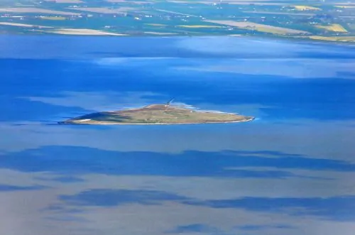
The medieval colonization of North Frisia was not a simple story of people wandering foolishly into danger. It was a deliberate and technically sophisticated transformation of a difficult coast. Settlers, landholders, religious institutions, and local communities expanded into marshes and fenlands because the rewards were considerable. Reclaimed land could support pasture, grain, livestock, salt production, peat extraction, and coastal trade. In a region where natural elevation was scarce, the ability to make land usable was a form of wealth and power. The same landscape that had once required accommodation now invited intervention. If fields could be drained, if houses could be raised, if water could be diverted, and if dikes could hold against ordinary tides, then the North Frisian coast could become not merely habitable but prosperous.
The earliest and most adaptive form of settlement rested on elevation. Terps, warften, and other dwelling mounds allowed people to live within a wetland world without entirely separating themselves from it. These raised platforms protected houses, storage spaces, livestock, and churches from regular flooding while leaving the wider marsh open to tidal influence. Their logic was vertical rather than exclusionary. The water might still enter the landscape, but the people, animals, and sacred or communal buildings were lifted above it. This was an old North Sea strategy, used in different forms along the Frisian and German coasts, and it reflected a practical recognition that floodwater could be endured if it did not destroy the core of settlement life. A terp did not deny the sea; it negotiated with it.
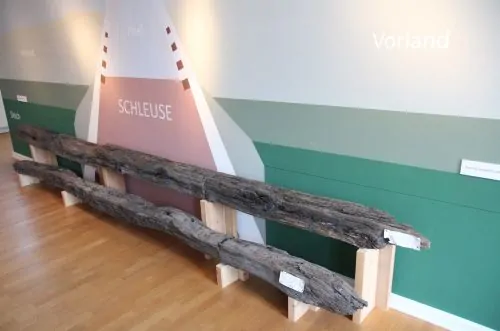
Settlement expanded from raised habitation toward more ambitious forms of landscape control. Dikes offered a different promise. Instead of lifting individual settlements above water, they attempted to keep water out of whole tracts of land. Ring dikes enclosed marsh islands or settlement zones; sea dikes marked harder boundaries against tidal water; smaller embankments protected fields, paths, and drainage networks. Once enclosed, land could be organized more intensively. Ditches could carry excess water away from fields. Sluices and tidal gates could release freshwater at low tide while preventing seawater from entering at high tide. Roads, parcels, and settlement rows could be laid out with greater regularity. Diking did not merely protect land that already existed. It created a new kind of land: enclosed, drained, measured, inherited, taxed, and worked as a stable possession.
This transformation required social organization as much as technical skill. Dikes were not private conveniences that could be built once and forgotten. They demanded labor, coordination, inspection, repair, and authority. A weak point in one section could endanger many households, so coastal defense bound communities together in practical obligation. Drainage systems likewise required shared maintenance, because water followed gradients rather than property lines. Medieval North Frisia was colonized not simply by individual farmers but by communities capable of managing collective infrastructure. The resulting landscape was political as well as environmental. Whoever controlled dikes, drainage, reclaimed fields, and access routes helped define the terms of settlement itself. The making of land was also the making of local power.
Geoarchaeological evidence from the Rungholt area shows how dense and deliberate this human-made coastal order became. Modern investigations have identified dwelling mounds, ditches, dike lines, field types, tidal gates, and settlement traces beneath the present Wadden Sea around Hallig Südfall. These features point to a carefully structured marshland, not a marginal scatter of desperate huts. The arrangement of mounds and drainage channels suggests planned use of the landscape, while the scale of ecclesiastical remains indicates a community embedded in wider religious and administrative networks. Rungholt’s world was both rural and connected. Its people worked reclaimed land, but they were not isolated from medieval commerce, church organization, or regional authority. The very existence of such infrastructure reveals confidence: the inhabitants believed the coast could be managed, defended, and made productive.
Yet the success of this system changed the terms of risk. A community living on terps could survive some floods because the water passed through the landscape while people remained above it. A community living behind dikes depended on those dikes remaining intact. Drained fields were more usable, but they were also more vulnerable if the enclosing walls failed. Drainage lowered water tables and altered soils; embankments separated marshes from sediment-bearing tides; channels and sluices required continual function; reclaimed fields depended on the assumption that the sea would remain outside the line drawn against it. This did not make diking a mistake in any simple sense. Without it, high medieval expansion in North Frisia would have been far more limited. But it did mean that prosperity became tied to an increasingly brittle structure. The better the land worked in ordinary years, the more people, animals, buildings, and wealth accumulated behind defenses that had to succeed in extraordinary ones.
The medieval colonization of North Frisia created both Rungholt’s strength and its vulnerability. Dikes, terps, drainage systems, and reclaimed fields made possible a thriving coastal society in a place that nature had not offered as secure ground. They turned marsh and fen into property, parish, pasture, and port. But they also narrowed the margin between safety and catastrophe. Once people had converted an amphibious landscape into engineered land, they could no longer rely on the older flexibility of marsh, creek, and peat. They had made a coast that required maintenance, coordination, and confidence, and for generations that confidence seemed justified. Saint Marcellus’ Flood would later reveal the hidden weakness in that achievement: the land had been made, but it had also been made dependent.
Rungholt the Prosperous
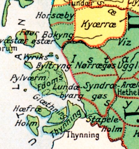
Rungholt matters because it was not merely a place that disappeared. It was a place whose disappearance carried weight because it belonged to one of the richest and most intensively used coastal landscapes of medieval North Frisia. Later legend exaggerated Rungholt into a kind of northern Atlantis, a city of luxury and sin drowned for its arrogance, but the legend rested on a historical memory of unusual prosperity. The settlement lay within the Edomsharde, part of the island and coastal district later remembered through the shattered geography of Strand. This was not a peripheral wilderness. It was a reclaimed marsh world tied to agriculture, livestock, ecclesiastical organization, regional lordship, and North Sea movement. Rungholt’s importance came from that combination: it was at once a settlement of farmers, a parish center, a node of trade, and a symbol of how much wealth medieval people could draw from an engineered coast.
The prosperity of Rungholt began with land. Reclaimed marshland could be extraordinarily productive when drainage and diking worked as intended. Cattle and sheep could graze on rich coastal pastures; hay and grain could be produced from fertile soils; peat could be cut for fuel; and salt, fish, birds, reeds, and other wetland resources could be drawn from the wider amphibious environment. The wealth of such a place was not simply commercial in the narrow sense. It was ecological wealth converted into medieval property. Every ditch, dike, field boundary, dwelling mound, and sluice represented labor invested in turning uncertain ground into usable land. Rungholt’s prosperity was built on this productive conversion of marsh and fen into a landscape that could support population, surplus, and exchange.
Its location also mattered. The North Frisian coast was not an isolated edge of Europe but part of a maritime world linking the German, Danish, Frisian, Dutch, and English North Sea zones. Water that threatened settlement also connected it. Creeks, tidal channels, and navigable inlets could carry goods, people, news, and authority through a landscape where overland travel was often difficult. Rungholt’s association with harbor activity and trade should be understood within this broader coastal economy rather than imagined as a stone-built urban port in the style of larger Hanseatic towns. It was more likely a marshland trading place whose prosperity depended on access to waterways, agricultural surplus, and regional exchange. Such a place did not need massive walls, paved streets, or monumental civic architecture to be economically important. Its value lay in its position between land and water: close enough to productive marsh fields to gather surplus, close enough to tidal routes to move goods outward, and organized enough to serve as a local center for exchange. Livestock products, grain, salt, peat, fish, and imported goods could all pass through this coastal network, binding reclaimed land to maritime circulation. Rungholt’s importance lay not in monumental urban form, but in its ability to gather the products of a rich reclaimed district and connect them to wider markets.
The parish dimension is equally important. The recent identification of a large church foundation in the Rungholt area gives archaeological substance to what memory and documentary traces had long suggested: this was a socially organized community with religious and administrative significance. A major church was not simply a building for worship. In a medieval coastal district, it was a marker of settlement density, wealth, obligation, and communal identity. It gathered people for liturgy, burial, feast days, legal announcements, tithes, memory, and local authority. Its size and location helped define Rungholt not as a loose scattering of houses but as a focal point in a wider inhabited landscape. The church also made the eventual destruction more culturally devastating. When Rungholt drowned, a parish world drowned with it: not just homes and fields, but graves, sacred space, records, and the institutional center around which ordinary lives had been organized.
Rungholt’s prosperity also depended on power. Reclaimed coastal land required defense, and defense required organization. Dikes, drainage works, and tidal gates demanded collective labor; disputes over land, water, grazing, and maintenance required recognized authority; trade and taxation linked the marsh communities to larger political structures. Medieval North Frisia sat within overlapping zones of local Frisian privilege, Danish authority, ecclesiastical jurisdiction, and regional lordship. The presence of Rungholt in historical memory as a wealthy place is inseparable from the administrative world that made wealth visible and extractable. Productive land could be assessed. Parishes could be organized. Goods could be moved. Obligations could be imposed. The coast was not merely being farmed; it was being governed.
This is why Rungholt should not be imagined only through the romance of ruins beneath the sea. Its drowned remains point to a dense cultural landscape: dwelling mounds arranged across reclaimed ground, ditches structuring fields, dikes protecting enclosed land, possible harbor features connecting the settlement to waterways, and a large church anchoring communal life. These features reveal a society that had succeeded, for a time, in making the Wadden Sea edge into a prosperous human environment. They also show how settlement, economy, and belief were physically embedded in the same fragile terrain. A dwelling mound was not only a house platform; it was a claim to permanence. A ditch was not only a drain; it was a line of labor, property, and maintenance. A dike was not only protection; it was the boundary of a collective wager that the enclosed land could be held against the sea. The church, rising within this reclaimed world, gave spiritual and institutional form to that wager. It sanctified a community whose daily life depended on water control and whose prosperity came from the successful conversion of wetland into usable ground. The very richness later attached to Rungholt’s legend may preserve the memory of that success, even when the legend distorted its meaning. Stories of a proud and wealthy town punished by God were not careful historical accounts, but they did remember something essential: Rungholt had been worth remembering because it had been more than ordinary.
Yet the same prosperity made the coming disaster sharper. The more successful Rungholt became, the more people and property accumulated in a landscape that remained physically precarious. Fields, livestock, parish buildings, trade facilities, homes, and stored wealth all depended on dikes and drainage continuing to function. The port and parish were not separate from the environmental problem; they were products of it. Rungholt was prosperous because people had made land from wetland, and that achievement encouraged further confidence in the system that sustained it. Saint Marcellus’ Flood would later expose the cost of that confidence. The sea did not merely destroy a poor fringe settlement clinging to marginal ground. It struck a wealthy reclaimed landscape whose success had drawn people, labor, faith, and power into a place where the line between land and water had always remained negotiable.
Removing Their Protection: The Slow Disaster Before the Flood
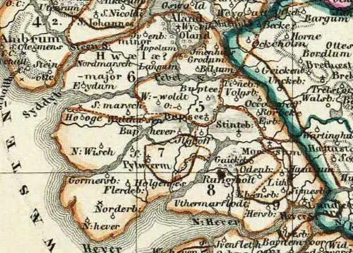
The destruction of Rungholt began long before the storm surge of January 1362. It began in the ordinary work of making the coast productive: cutting peat, digging ditches, lowering water tables, enclosing marshes, and extending cultivation into landscapes that had once survived by remaining wet. This is the central paradox of the Rungholt disaster. The same practices that made North Frisia wealthier also made it lower, drier, and more exposed. Medieval inhabitants did not set out to endanger themselves. They sought fuel, farmland, pasture, salt, and settlement space in a coastal world where usable land was precious. But the Wadden Sea margin was not passive material. It was an organic and sedimentary system whose stability depended on waterlogged peat, marsh accumulation, and the constant exchange of tide and sediment. To improve it was also to change how it endured the sea.
Peat was important because it was both resource and protection. To medieval communities, peat offered fuel in a region where woodland was scarce, and it could also be tied to agricultural improvement, salt production, and the broader economy of reclaimed land. But peat was not simply something lying on top of the coast like removable surplus. It was accumulated landscape. Layer by layer, plant remains had built up under wet conditions where decomposition was slow. That accumulation gave parts of the coastal lowlands height, mass, and water-holding capacity. A thick peat surface could act as a sponge, a platform, and a buffer. When people cut into it, they were not merely harvesting fuel. They were physically removing part of the ground on which their settlement system depended.
Drainage intensified the damage. Waterlogged peat preserves volume because its organic material remains saturated. Once drained, peat begins to shrink, compact, oxidize, and lose height. Ditches that made fields workable also pulled water out of soils whose elevation had depended on remaining wet. The process could be gradual enough to escape notice across a single lifetime, yet profound across generations. A field that became easier to plow or graze after drainage might also become slightly lower, and then lower still, until its usefulness depended more completely on dikes, sluices, and pumps of human labor. In a coastal zone where survival could depend on differences of less than a meter, this mattered enormously. Subsidence did not need to be dramatic to be dangerous. It only needed to reduce the margin between inhabited land and storm tide. The dike compounded this transformation in a subtler way. Embankments protected reclaimed land from ordinary tidal flooding, but they also interrupted the natural delivery of sediment. In an open marsh, tides could spread silt across the surface, allowing the land to gradually build upward. Behind a dike, that regular vertical growth was reduced or stopped. The enclosed field might become more valuable immediately because it was drier and more controllable, but it also became separated from the processes that had helped the marsh keep pace with water. This was one of the great trade-offs of medieval reclamation. The community gained a more stable agricultural surface in daily life, while slowly losing the adaptive capacity of a living marsh. The land behind the dike became less amphibious, but not necessarily safer.
This produced what might be called the slow disaster before the flood. Nothing about it required a single catastrophic decision. No one needed to cut all the peat at once or build one fatally flawed dike. Instead, risk accumulated through ordinary, useful, profitable habits. One generation drained a field; another extended a ditch; another cut peat from a surface that still seemed abundant; another repaired and heightened a dike rather than questioning the settlement pattern behind it. The coast continued to function, and that functioning reinforced confidence. Cattle grazed, crops grew, church bells rang, goods moved, and property passed from hand to hand. The very normality of life concealed the extent of environmental change. Rungholt’s vulnerability was not created in a moment of panic, but in a long season of success.
Modern geoarchaeological studies have made this slow disaster visible. Around the Rungholt area, researchers have identified buried and eroded settlement features, dike systems, drainage networks, former marsh surfaces, and stratigraphic evidence for the transformation of cultivated land into tidal flats. The crucial argument in recent scholarship is that the 1362 flood did not simply wash across a naturally low but otherwise intact coast. It struck a landscape already lowered and weakened by medieval peat exploitation and drainage. In some places, cultivated surfaces may have stood below mean high water before the storm arrived, protected only by dikes and the continued operation of the human-made drainage network. If that is correct, then the catastrophe was not merely that water overtopped defenses. It was that, once the defenses failed, the land behind them no longer possessed the elevation or resilience necessary to recover. This does not mean medieval North Frisians were ignorant or uniquely reckless. They understood water, dikes, tides, and coastal labor far better than outsiders did. Their achievements were real, and their techniques made possible centuries of habitation in a demanding environment. The problem was structural rather than moral. The benefits of reclamation appeared annually, while the costs accumulated slowly and unevenly. Fuel could be burned immediately; drained fields could be used immediately; protected pastures could support animals immediately. Subsidence, oxidation, sediment starvation, and the reduction of storm resilience unfolded over longer timescales. Medieval coastal society faced a familiar human problem: the rewards of environmental transformation were local, visible, and profitable, while the dangers were delayed until an extreme event revealed them all at once.
By the time Saint Marcellus’ Flood struck, Rungholt’s defenses were not only made of dikes. They were made of assumptions: that reclaimed land would remain land, that the sea could be held outside, that peat could be removed without consequence, that drainage was improvement, and that a prosperous coastal order could be maintained by repairing the structures that enclosed it. The storm shattered those assumptions because the physical landscape had already been stripped of much of its old protection. The North Sea did not need to create vulnerability from nothing. It found vulnerability prepared. Rungholt drowned not simply because a great storm came, but because generations of land use had turned a wetland buffer into a lowered, enclosed, and dependent landscape. The people had not removed a wall. They had removed the ground’s own capacity to resist.
The Grote Mandrenke

The storm that struck the North Sea coast in January 1362 was remembered by names that already carried judgment and scale: the Grote Mandrenke, the “Great Drowning of Men,” and the Second Saint Marcellus Flood. Its association with Saint Marcellus came from the feast day near the height of the catastrophe, January 16, though reports and later reconstructions place the storm surge across a broader span of January 15–16. Medieval sources did not describe the event with modern meteorological precision, but they preserved the essential fact that a violent North Sea storm drove water across a vast coastal region. The flood affected more than North Frisia alone. It was part of a wider southern North Sea disaster that touched parts of the British Isles, the Low Countries, northern Germany, Schleswig, and Denmark. Yet in North Frisia, and especially in the Rungholt landscape, the flood became something more permanent than inundation.
A storm surge is not simply high water. It is the piling up of the sea by wind, pressure, tide, coastal shape, and timing. The North Sea is vulnerable to this kind of disaster because it narrows toward the German Bight, where wind-driven water can be forced into shallow coastal basins and against low marshland shores. If such a surge coincides with high tide, and if the wind continues to press water landward, ordinary coastal boundaries can fail quickly. Medieval people did not need modern instruments to understand this danger. They knew the North Sea as a violent neighbor, and they built dikes, mounds, and drainage systems because they had lived with the memory of earlier floods. What made 1362 exceptional was not that people had never seen floodwater before, but that the scale and force of the surge exceeded the working assumptions of the coastal infrastructure.
The first destruction came through breach. Dikes were designed to resist ordinary tidal water and many lesser storms, but they were vulnerable where height, maintenance, material, foundation, or angle failed. A storm surge could overtop a dike, saturate it, scour its landward side, or open a weak point that widened under the pressure of rushing water. Once a breach formed, the defense no longer behaved like a wall; it became a channel. Water entering through a broken dike could tear at the opening, deepen it, carry sediment away, and turn a local failure into a landscape-scale rupture. In a reclaimed marsh already cut by ditches and drainage lines, incoming seawater could move rapidly along the very networks built to control water. The infrastructure of improvement could become, in the moment of disaster, a pathway of destruction.
For Rungholt, the most important distinction is between flooding and drowning. A flood covers land temporarily; drowning changes what the land is. Many medieval communities could survive a storm if water withdrew and if houses, livestock, fields, and dikes could be repaired afterward. But in a lowered reclaimed landscape, a breached defense might expose land that no longer stood high enough to recover easily. Fields that had depended on drainage could become tidal basins. Ditches could enlarge into creeks. Broken dike lines could invite repeated tidal exchange. Sediment could be stripped away in some places and deposited destructively in others. Once the sea had entered deeply enough, repair was no longer a matter of removing water from fields. The sea had claimed the system that made the fields possible. A community could rebuild a damaged wall, but it could not easily rebuild the lost elevation of peat, the compacted height of drained soils, or the vanished balance between marsh surface and tide. The disaster crossed a threshold from event to transformation. The landscape was not simply wet; it was reclassified by water. What had been inside the dike became outside it, what had been field became tidal flat, and what had been a human-maintained environment became part of the sea’s daily rhythm.
This is why the destruction of Rungholt became so absolute in memory. The town was not merely damaged and rebuilt in reduced form. It vanished from ordinary geography. Later generations remembered a lost port, a drowned church, and a wealthy community erased beneath the tide, but they no longer possessed Rungholt as a functioning place. In historical and legendary memory, that disappearance acquired moral and supernatural explanation: bells beneath the water, arrogance punished, wealth swallowed by the sea. Yet the physical logic was harsher and more material. If reclaimed land had already sunk, if peat had been removed, if fields lay below the level of ordinary high water, and if storm breaches opened the coast to renewed tidal flow, then the sea did not need to carry Rungholt away all at once. It needed only to make the old human system impossible to restore. The disappearance of the town was not only a matter of buildings destroyed or people killed, but of landscape failure. Roads, property boundaries, parish structures, fields, drainage works, and local routes made sense only within the reclaimed order that had sustained them. Once that order broke, the map itself became obsolete. Rungholt survived as memory because it no longer survived as territory; its social world had been unmade by a physical change too extensive to reverse.
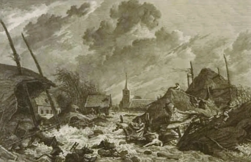
The human experience of the flood must have been terrifyingly immediate. A coastal storm was not an abstract environmental process to those living behind dikes in January darkness. It was noise, wind, failing embankments, rising water, animals breaking loose, houses collapsing or floating from their foundations, families trying to reach higher ground, and communities discovering that the protections around which daily life had been organized could vanish in hours. Dwelling mounds and churches may have offered temporary refuge, but if water continued to rise or currents cut through the surrounding land, even raised places became islands of fear. The loss of life traditionally attached to the Grote Mandrenke may be impossible to verify in exact numerical terms, but the persistence of very high casualty figures reflects how the event was understood: not as a routine storm, but as a social catastrophe that overwhelmed the ordinary categories of coastal danger.
The Grote Mandrenke stands at the turning point between the slow disaster and the visible one. Before January 1362, the danger had accumulated quietly in drained soils, cut peat, enclosed marshes, and confidence in maintained defenses. During the storm, that accumulated vulnerability was converted into catastrophe. Wind and tide supplied the violence, but breach and drowning translated that violence into permanent loss. Rungholt’s fate lay in this sequence. The storm surge struck the dikes; the dikes failed; the sea entered a landscape already lowered and dependent; and the reclaimed world could not rise again. What had been a prosperous coastal district became part of the Wadden Sea, and what had been a parish, port, and settlement became one of medieval Europe’s most enduring images of land lost to water.
After the Water: Permanent Land Loss and the Archaeology of Absence
After the Grote Mandrenke, the most important fact about Rungholt was absence. The settlement did not survive as a damaged town with a reduced population, a rebuilt parish, or a repaired harbor. It disappeared from the lived geography of North Frisia and entered a different kind of existence: as memory, legend, archival trace, and submerged archaeological landscape. This is what makes the 1362 flood so different from many other medieval inundations. Flooded land could sometimes be drained again. Broken dikes could sometimes be closed. Villages could sometimes be rebuilt on the same ground or nearby. But in the Rungholt area, the disaster produced a more permanent conversion. The old cultural landscape became part of the tidal Wadden Sea, and the evidence of human life was left scattered, buried, eroded, and periodically exposed by the movement of mud and water.
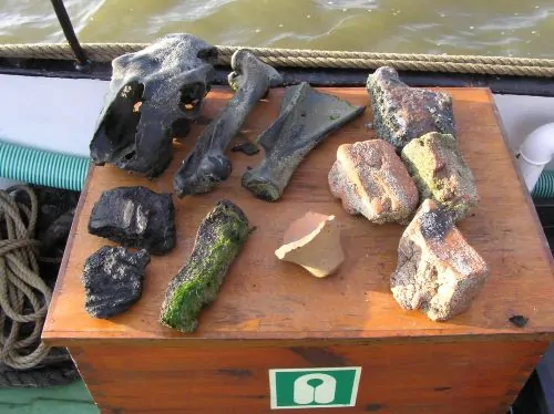
The archaeology of Rungholt is an archaeology of things partly missing. Researchers are not examining a preserved medieval city beneath clear water, nor a ruin standing in place like a drowned cathedral. They are reconstructing a landscape from fragments: traces of dwelling mounds, drainage ditches, dike lines, field systems, tidal-gate structures, pottery, brick, imported goods, buried cultural layers, and geophysical anomalies beneath tidal-flat sediments. Much of what once stood above ground has been destroyed by centuries of erosion. Wooden buildings, earthen walls, paths, fences, and many everyday objects would have been carried away, decomposed, or reworked by tidal action. Even the large church foundation recently identified near Hallig Südfall survives less as a building than as a footprint, a pattern of remains from which archaeologists infer the scale and importance of what once occupied the site. That makes the site intellectually powerful but methodologically demanding. Rungholt has to be read through interruption: a ditch that stops where erosion has removed its continuation, a mound reduced to a subsurface trace, a cultural layer sealed below later marine deposits, a brick concentration that hints at institutional architecture rather than preserving it intact. The sea has not handed historians a complete medieval town; it has left them the damaged grammar of a lost landscape. Each fragment has to be placed back into relation with the others before the vanished settlement becomes visible.
This absence is not a weakness in the evidence; it is part of the evidence. The missing terp surfaces, eroded settlement mounds, truncated cultural deposits, and overlying tidal-flat sediments all testify to the force and permanence of the landscape change. A place that had once been inhabited, cultivated, and organized was not merely abandoned; it was physically dismantled. Stratigraphy can show where older marsh or settlement surfaces were cut away and replaced by post-flood marine deposits. Coring can reveal buried peat, clay, cultural horizons, and the sudden or gradual transition from lived landscape to tidal environment. Geophysical survey can map features that no longer appear at the surface, allowing researchers to see the outline of a vanished world beneath the flats. Rungholt’s disappearance is readable precisely because the sea did not preserve it whole. It erased enough to show that erasure itself was the historical event. The negative evidence matters: the absence of intact settlement layers where they should have been, the loss of mound height, the replacement of human surfaces by marine sediments, and the survival only of deeper or more durable traces. These are not simply gaps in knowledge. They are the marks of a landscape that crossed from occupation into exposure, from field into tidal flat, from parish territory into seabed. Archaeology here does not merely recover what survived; it interprets what was removed.
The modern recovery of Rungholt has depended on combining methods that can work in a landscape where ordinary excavation is difficult. Magnetic gradiometry can detect buried ditches, foundations, and disturbances in the sediment. Seismic reflection and electromagnetic methods can help identify subsurface structures and layers. Sediment cores provide vertical histories of deposition, erosion, peat formation, marine overwash, and human alteration. Old maps, medieval references, later chronicles, local memory, and place-name traditions offer clues, but they must be tested against the ground itself. This combination of historical and scientific evidence is important because Rungholt has long been wrapped in legend. Without geoarchaeology, the drowned city could remain a story. With it, the story becomes a landscape whose destruction can be measured, mapped, and interpreted.
The evidence also complicates what it means to say that Rungholt was “destroyed.” A town may be destroyed when its houses fall, but a cultural landscape is destroyed when the relationships that made it function are broken. In Rungholt’s case, those relationships included the elevation of dwelling mounds, the drainage of fields, the enclosure of marshes, the connection between waterways and trade, the parish church as a communal center, and the dike system as the boundary between usable land and sea. The flood did not need to obliterate every trace of these things in a single night. It needed to break their system. Once tidal water returned repeatedly through breached defenses, once fields became flats, once drainage ditches became part of a marine network, and once settlement mounds were eroded rather than maintained, the old order could no longer be restored. The archaeology of the area records not just death, but de-functioning: the moment when a human landscape ceased to operate as one.
That is why the afterlife of Rungholt matters to the my larger argument. The permanent land loss visible in the Wadden Sea is the material proof that the disaster was more than a storm story. Had the land retained enough height and resilience, 1362 might have been remembered as a terrible flood followed by repair. Instead, it became the drowning of a place. Modern research reveals a medieval society that had successfully engineered a marshland world, but also a landscape whose altered condition made recovery far more difficult once the sea returned. Rungholt’s absence is not empty. It is the most powerful evidence of all. The missing town, the vanished parish, the eroded mounds, and the tidal flats that replaced cultivated ground all point to the same conclusion: the flood did not simply pass over the land; it ended the land’s human form.
The Moral Flood: How Rungholt Became a Warning Story
Rungholt did not disappear only into the sea. It disappeared into story. Once the town could no longer be visited, repaired, taxed, farmed, or rebuilt, it became available to memory in a different form: as a drowned city whose loss demanded explanation. Coastal communities did not remember the Grote Mandrenke only as a physical storm surge. They remembered it as a rupture in the moral and social order, an event so overwhelming that ordinary causation seemed insufficient. Why had the sea taken this place? Why had so many people died? Why had a wealthy parish landscape vanished while other places survived? In the centuries after the flood, the answer increasingly became moral. Rungholt was remembered as a proud, rich, impious community punished by water. That transformation from place to parable mattered because it gave shape to grief. A destroyed landscape leaves survivors not only with material loss, but with interpretive pressure: the need to make the catastrophe mean something. Rungholt’s disappearance was too large, too sudden, and too complete to remain only a record of broken dikes and lost fields. It became a story through which later generations could think about danger, wealth, faith, and the limits of human control along the North Sea coast.
This moral interpretation belonged to a much older habit of explaining disaster. Medieval and early modern Christians often read floods, fires, plagues, famines, and storms as providential warnings. Disaster did not merely happen; it signified. It exposed sin, punished arrogance, corrected luxury, or reminded communities of divine power. The North Sea, already dangerous in practical terms, could become a theological agent. Its violence was not only wind and tide but judgment. In that framework, the drowning of Rungholt became more than the destruction of a settlement. It became a sermon in landscape form. The vanished town proved that wealth could not protect sinners, that dikes could not defeat God, and that human pride was weakest precisely where it imagined itself secure.
The Rungholt legend developed especially around the contrast between wealth and punishment. Later tradition imagined the town as unusually prosperous, crowded, proud, and morally corrupt. Some versions emphasized luxury, drunkenness, mockery of sacred things, or deliberate disrespect toward religious authority. The details varied, but the structure remained consistent: Rungholt had been rich; its people had misused their wealth; warning had been ignored; the sea had answered. This kind of storytelling did not preserve reliable social history in a simple way. It tells us less about what Rungholt’s inhabitants actually did than about how later communities interpreted sudden loss. Yet it also carried a distorted memory of real prosperity. A poor and insignificant place would not so easily have become a legend of arrogance. The moral tale required Rungholt to be wealthy because its lesson depended on the fall of a community that seemed secure.
Early modern chronicling helped fix that memory. Anton Heimreich’s seventeenth-century Nordfresische Chronik, written long after 1362 and in the shadow of later North Frisian flood disasters, became important in shaping how Rungholt was remembered. Heimreich was not an eyewitness to the medieval catastrophe, and his account should not be read as a contemporary report. It belongs instead to the world of confessional history, regional memory, and providential interpretation. That makes it historically limited but culturally revealing. By the seventeenth century, North Frisia had suffered repeated storm floods, including the catastrophic Burchardi Flood of 1634, and Heimreich’s world knew very well that the sea could still destroy reclaimed land. Rungholt’s story became a usable past. It allowed later North Frisians to connect their own vulnerability to an older example of drowned pride, divine warning, and coastal fragility. In that sense, Heimreich’s account tells us as much about the memory culture of the early modern coast as it does about the medieval event itself. The chronicle gathered inherited traditions, moral explanations, and regional identity into a narrative that made the drowned town legible. Rungholt became a precedent, a warning that could be invoked whenever the sea again reminded North Frisians that settlement behind dikes was never absolute possession but always conditional occupation.
The nineteenth century gave the legend a new literary force. Detlev von Liliencron’s ballad “Trutz, Blanke Hans” transformed Rungholt into one of the most memorable poetic images of the North Sea. In the poem’s world, Rungholt is not merely flooded; it defies the sea, and the sea answers with annihilating power. “Blanke Hans,” the personified North Sea, becomes both monster and judge, a force that no human confidence can finally master. Liliencron’s poem did not create the legend from nothing, but it gave it emotional durability. It turned local memory into national literature and made Rungholt less an archaeological problem than a symbolic landscape. The drowned city became a warning against arrogance before nature, against the illusion that human wealth or engineering could make the coast harmless.
Modern geoarchaeology changes the meaning of that warning without erasing it. The old legend was wrong if it is read literally as divine punishment for moral sin. There is no historical basis for treating Rungholt’s inhabitants as unusually wicked, nor should disaster be explained by blaming victims through pious storytelling. Yet the legend’s structure contains an irony that modern science makes sharper. Rungholt may not have drowned because its people mocked God, but it did drown in part because human prosperity had altered the coast that protected them. The “sin,” if one uses the word metaphorically, was not carnival excess or impiety. It was the successful conversion of wetland into wealth without full recognition of the long-term cost: peat removed, soils drained, marshes enclosed, land lowered, and confidence placed in defenses that could fail. This reframing does not simply replace religion with science; it changes the object of judgment. The question is no longer whether the people of Rungholt deserved destruction, but whether their society had built prosperity by consuming the ecological conditions that made safety possible. The legend moralized the disaster; modern environmental history materializes it. It turns punishment into process, pride into infrastructure, and divine wrath into the accumulated consequences of land use.
Rungholt remains a warning story, but not the same warning later storytellers imagined. Its lesson is not that the sea punishes luxury, nor that catastrophe proves divine anger. It is that societies often explain disaster after the fact in ways that hide the slow processes that made disaster possible. Moral memory turned Rungholt into a tale of pride because pride was easier to narrate than peat compaction, drainage, sediment starvation, subsidence, and dike failure. But the legend endured because it captured a deeper emotional truth: people had trusted a made landscape, and the sea had exposed that trust as fragile. The bells beneath the tide, the vanished church, the arrogant city, and the terrible “Blanke Hans” are not evidence in the archaeological sense. They are evidence of another kind: proof that the destruction of Rungholt left a wound large enough that later generations needed the sea itself to speak.
A Medieval Anthropocene? Rungholt and the Long History of Human-Made Vulnerability
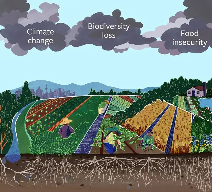
Calling Rungholt a “Medieval Anthropocene” is useful only if the phrase is handled carefully. The term Anthropocene usually refers to the modern era in which human activity has become a planetary geological force, especially through industrialization, fossil fuels, mass extraction, and global climate change. Medieval North Frisia was not that. Its people did not alter the chemistry of the atmosphere, drive global warming, or command industrial energy systems. Yet Rungholt does reveal something older than the modern Anthropocene: the capacity of human societies to reshape environments so deeply that natural hazards strike through human-made vulnerabilities. The scale was regional rather than planetary, but the pattern is recognizable. People changed the land, benefited from the change, normalized the risk, and then experienced a disaster whose severity cannot be explained by nature alone.
The most important lesson is that disasters are rarely single events. A storm, earthquake, drought, or flood may supply the moment of violence, but the disaster is usually prepared beforehand by settlement choices, economic systems, political priorities, labor arrangements, and environmental alteration. Rungholt was destroyed in January 1362, but its vulnerability had been produced over generations. Reclamation made the coast profitable; drainage made fields workable; peat extraction supplied fuel and land; dikes created defensible boundaries between sea and settlement. Each step made sense within medieval coastal society. They transformed a flexible wetland into a lowered, artificial landscape that required continuous success from its defenses. The storm surge was sudden. The disaster was cumulative.
This distinction matters because it shifts attention from blame to structure. It would be easy, and wrong, to turn Rungholt into a simple morality tale about foolish medieval people destroying themselves. They were not fools. They were skilled coastal inhabitants who understood tides, dikes, marshes, and water management through hard experience. Their techniques allowed communities to live and prosper in a region that would otherwise have supported far fewer people. The problem was not ignorance in the ordinary sense, but the uneven visibility of risk. Benefits appeared immediately: more land, more pasture, more fuel, more settlement, more wealth. Costs appeared slowly: subsidence, lowered ground, sediment starvation, dependence on embankments, and the erosion of older wetland resilience. A society can be highly competent and still build itself into danger when its successes depend on consuming the conditions of its own safety.
That is why Rungholt belongs in the long history of human-made vulnerability. The people of North Frisia did not cause the North Sea storm, but they helped determine what the storm could do once it arrived. Human action shaped the elevation of the land, the arrangement of fields and ditches, the placement of settlements, the condition of dikes, and the degree to which flooded ground could recover afterward. This is the essential difference between hazard and disaster. The hazard was the storm surge; the disaster was the encounter between that surge and a human landscape made fragile by its own improvement. In that sense, Rungholt resembles later and larger disasters in which floodplains are urbanized, forests are cleared from unstable slopes, wetlands are drained for development, or coastlines are hardened in ways that increase dependence on engineered defenses. The medieval case is smaller, but the logic is not alien. Human beings often treat the landscape as background until a crisis reveals that the background has been actively produced. A storm striking an uninhabited coast is a physical event; a storm striking drained fields, crowded settlements, parish churches, livestock herds, trade routes, and legally organized property is a social disaster. Rungholt makes that distinction visible because the sea’s violence was filtered through a landscape already shaped by human choices. What drowned was not “nature” in isolation, but a human-natural system whose productive success had made it more exposed to failure.
The word Anthropocene also helps illuminate the problem of time. Environmental risk often accumulates on a different timescale from political decision-making and everyday life. A family cutting peat, digging drains, or maintaining fields might see practical gain rather than systemic danger. A parish community repairing dikes might understand itself as prudent and responsible. A landholder expanding cultivation might see prosperity, not subsidence. Yet the landscape keeps its own account. Peat that took centuries to form can be removed in decades. Soil that loses water can lose height slowly but steadily. A marsh separated from tidal sedimentation can become less able to adjust to changing water levels. These processes may remain below the threshold of crisis until an extreme event converts gradual change into sudden catastrophe. The flood reveals the history that produced it.
Rungholt also shows that environmental disasters are cultural events because societies interpret them through the stories they have available. Medieval and early modern memory turned the disaster into a tale of sin, pride, and divine punishment. Modern scholarship turns it toward peat extraction, drainage, dike systems, marshland destruction, and permanent land loss. These explanations are not equivalent, but they are both attempts to connect physical destruction to human meaning. The older legend blamed moral corruption; the modern interpretation identifies environmental transformation. The difference is crucial. One explanation condemns the victims for impiety; the other asks how a prosperous society became dependent on a damaged landscape. Yet both forms of memory recognize that Rungholt’s destruction was not felt as an ordinary storm. It was experienced as a revelation that the world people trusted had failed.
The danger in using a phrase like “Medieval Anthropocene” is that it can flatten historical difference. Medieval reclamation was not industrial capitalism, and the Grote Mandrenke was not climate change in miniature. North Frisian communities did not possess modern scientific models of subsidence, sea-level trends, or wetland ecology. Their choices were constrained by the needs of fuel, food, settlement, and survival. Nor should modern observers pretend that leaving the marsh untouched was an obvious or available alternative. Human beings have always lived by altering environments. The point is not that intervention itself was wrong. The point is that some forms of intervention reduce resilience while increasing dependence, and societies often discover that dependency only when ordinary conditions give way to extremes. The medieval context also matters because the language of environmental responsibility can too easily become anachronistic. Rungholt’s inhabitants did not act with the knowledge available to modern coastal science, and they were not choosing between ecological preservation and modern environmental management. They were making practical decisions within the pressures of medieval life: securing fuel, expanding usable land, protecting livestock, sustaining households, and maintaining communal defenses in a dangerous coastal economy. Recognizing the anthropogenic dimension of the disaster should deepen the analysis, not simplify the blame. It should show how rational decisions can produce irrational vulnerability when repeated across generations in a fragile environment.
Rungholt’s value as a historical case lies precisely in that complication. It is not a story of nature against humanity, nor of humanity conquering nature until nature takes revenge. It is a story of entanglement. Medieval North Frisians made land, and the land made their society possible. They built prosperity from marsh, peat, tide, and labor. But by making the coast more useful, they also made it more brittle. The Grote Mandrenke exposed that brittleness with catastrophic force. If Rungholt belongs to an Anthropocene history, it is not because it was modern before its time, but because it reveals an old human pattern: the transformation of protective environments into productive ones, the mistaking of engineered stability for permanent safety, and the arrival of a natural hazard that turns accumulated vulnerability into loss.
Was Rungholt Destroyed by Nature More Than by People?
The following video from “The History Guy: History Deserves to Be Remembered” covers the Grote Mandrenke:
The Grote Mandrenke was, first and undeniably, an extreme natural event. The storm surge of January 1362 was not limited to Rungholt, North Frisia, or even the German-Danish Wadden Sea. It struck across a broad North Sea world, damaging coasts whose local histories of land use, peat extraction, diking, and drainage differed considerably. Medieval observers remembered it as a vast regional catastrophe because it behaved like one. Wind, tide, atmospheric pressure, coastal geometry, and the shallow funneling of the North Sea produced a surge powerful enough to overwhelm communities that had long experience with coastal danger. On this view, Rungholt may have been destroyed not because its inhabitants had uniquely weakened their landscape, but because no medieval coastal society could fully withstand such an exceptional storm. To call the disaster anthropogenic may risk shrinking the power of the North Sea into a human morality tale of a different kind.
That facts challenges my arguments here deserve real weight. The inhabitants of Rungholt did not cause the gale, the tide, the storm track, or the surge. They were not modern engineers armed with centuries of hydrological modeling who chose recklessly to ignore known probabilities. Nor were dikes, drainage works, and marsh reclamation inherently foolish. In a low coastal region, they were the basis of settlement, food production, fuel supply, livestock wealth, and communal survival. It is also important to recognize the limits of the evidence. Rungholt’s exact population, wealth, harbor form, casualty figures, and local topography cannot be reconstructed with perfect certainty. Later chronicles and legends were written through memory, theology, and literary imagination, not as neutral field reports. Archaeology and geoarchaeology can recover patterns of land use and destruction, but they do not let historians replay the storm hour by hour or assign mathematical percentages of responsibility to wind, water, dikes, peat cutting, and drainage.
The counterpoint also warns against overstating Rungholt’s exceptionalism. The medieval North Sea coast was always dangerous. Storm floods had occurred before 1362 and would occur after it, including later disasters that destroyed reclaimed land despite generations of additional experience. Coastal communities lived with a recurring problem: the very areas most attractive for settlement and agriculture were often those most exposed to flood risk. A strong natural-hazard interpretation would argue that Rungholt’s fate belongs primarily to the history of North Sea storm surges, not to the history of environmental self-destruction. The town was vulnerable because all low-lying coastal settlements were vulnerable. Its disappearance became famous because it was dramatic, culturally memorable, and later wrapped in legend, not necessarily because its inhabitants had removed some decisive protection that would otherwise have saved it.
Yet this challenge modifies the argument more than it overturns it. The issue is not whether the storm was natural; it was. The issue is whether the consequences of the storm can be understood without the prior human transformation of the landscape. Here the evidence points back toward human-made vulnerability. Peat extraction removed elevation and mass from the coastal lowlands. Drainage compacted and oxidized organic soils. Diking protected land from ordinary tides while reducing the sedimentation that could help marsh surfaces maintain height. Reclamation encouraged population, property, livestock, churches, fields, and trade to accumulate behind defenses that required continual success. These processes did not create the hazard, but they shaped exposure, fragility, and recovery. A storm surge striking an intact wetland margin, a terp-based settlement pattern, or a higher marsh surface would not necessarily have produced the same permanent conversion of cultural land into tidal flats. What made Rungholt’s destruction so historically significant was not simply that water arrived, but that the land behind the defenses had become less able to survive its arrival.
The fairest conclusion is not that Rungholt was destroyed by people instead of nature, but that nature and people had become inseparable in the disaster. The Grote Mandrenke supplied the immediate violence; medieval land use supplied much of the vulnerability through which that violence operated. The counterpoint strengthens the final interpretation by preventing a crude claim of human causation. Rungholt was not a self-inflicted catastrophe in the simple sense, nor was it merely a victim of an unpredictable sea. It was a natural disaster amplified by an engineered landscape whose protective capacity had been reduced over generations. The storm explains the timing. Human alteration helps explain the permanence. The sea drowned Rungholt, but it drowned a world already lowered by the work that had made it rich.
Conclusion: The Land That Could Not Rise Again
Rungholt’s destruction endures because it was not only the loss of a town, but the failure of a whole way of making land. Medieval North Frisians had entered an amphibious world and transformed it with remarkable skill. They raised dwelling mounds, enclosed marshes, drained fields, cut peat, built dikes, organized parishes, supported trade, and turned a difficult coastal margin into a prosperous human landscape. For generations, that achievement must have seemed proof of mastery. The marsh could be made productive. The sea could be kept outside. The land could be improved, inherited, defended, and made to serve human need. Rungholt was the symbol of that success: a wealthy parish and trading place built where land and water had once remained uncertain.
Yet the same achievement carried its own weakness. The coast that sustained Rungholt had not simply been occupied; it had been lowered, dried, enclosed, and stripped of some of its natural resilience. Peat that had taken centuries to accumulate was removed for fuel, agriculture, and economic use. Drained organic soils compacted and lost height. Dikes protected reclaimed fields from ordinary tides while cutting them off from the sedimentation that had helped marsh surfaces rise. Settlement and wealth accumulated behind defenses that had to function continuously. By the time the Grote Mandrenke struck in January 1362, the storm did not encounter a neutral landscape. It encountered a human-made coastal system already dependent on artificial boundaries and already weakened by the processes that had made it valuable.
This is why the flood became drowning. A storm surge can be survived if water withdraws, fields can be drained, dikes can be repaired, and communities can return to ground that still possesses the physical capacity to support them. Rungholt’s tragedy was that the ground itself had crossed a threshold. When the sea breached the defenses, it did not merely cover the land; it reclaimed a lowered landscape that could no longer easily be restored. Fields became tidal flats, drainage networks became part of a marine system, settlement mounds eroded, and the parish world vanished from lived geography. Later memory turned that destruction into a moral tale of pride, sin, and divine punishment. Modern geoarchaeology tells a different story, but not a less powerful one. It reveals a disaster in which ordinary decisions, practical improvements, and profitable adaptations gradually consumed the protections that had once made the coast habitable.
Saint Marcellus’ Flood was both natural and historical. The North Sea supplied the gale, the surge, and the violence; human beings supplied much of the vulnerability through which that violence became permanent loss. Rungholt was not destroyed because its people were uniquely wicked, foolish, or doomed. It was destroyed because a successful medieval society built prosperity from a fragile wetland system without fully seeing how much of that system’s safety it was spending. The old legend imagined bells still ringing beneath the tide, as if the drowned city continued to speak from under the water. What it says now is clearer and colder. Disasters do not begin only when the storm arrives. They begin when societies lower the ground beneath their own feet and call it improvement.
Bibliography
Affiliate disclosure: Amazon links on this site are paid links. As an Amazon Associate I earn from qualifying purchases.
- Bankoff, Greg. “Time Is of the Essence: Disasters, Vulnerability and History.” International Journal of Mass Emergencies and Disasters 22:3 (2004), 23–42.
- Bantelmann, Albert, and Fritz Fischer. “Die Landschaftsentwicklung an der schleswig-holsteinischen Westküste, dargestellt am Beispiel Nordfriesland: Eine Funktionschronik durch fünf Jahrtausende.” Die Küste 14:2 (1966), 5–99.
- Behre, Karl-Ernst. “A New Holocene Sea-Level Curve for the Southern North Sea.” Boreas 36:1 (2007), 82–102.
- Chakrabarty, Dipesh. “The Climate of History: Four Theses.” Critical Inquiry 35:2 (2009), 197–222.
- Detmar von Lübeck. Detmar-Chronik von 1101/1395. In Curt Weikinn, Quellentexte zur Witterungsgeschichte Europas von der Zeitwende bis zum Jahre 1850, vol. 1. Berlin: Akademie-Verlag, 1958.
- Ehrentraut, Heinrich Georg, ed. Beiträge Zur Geschichte Der Friesen Und Ihrer Sprache, Auch Der Grafschaften Oldenburg Und Delmenhorst, Erster Band (German Edition). Boston: Legare Street Press, 2023.
- Hadler, Hanna, et.al. “Geoarchaeological Evidence of Marshland Destruction in the Area of Rungholt, Present-Day Wadden Sea Around Hallig Südfall (North Frisia, Germany), by the Grote Mandrenke in 1362 AD.” Quaternary International 473 (2018), 37–54.
- —-, et.al. “Medieval Overexploitation of Peat Triggered Large-Scale Drowning and Permanent Land Loss in Coastal North Frisia (Wadden Sea Region, Germany).” Geosciences 15:1 (2025), 1.
- Heimreich, Anton. Nordfresische Chronik. Edited by N. Falck. 2 vols. Tondern: Forchhammer, 1819.
- Hoffmann, Dietrich. “Holocene Landscape Development in the Marshes of the West Coast of Schleswig-Holstein, Germany.” Quaternary International 112 (2004), 29–36.
- Hoffmann, Richard C. An Environmental History of Medieval Europe. Cambridge: Cambridge University Press, 2014.
- Liliencron, Detlev von. “Trutz, Blanke Hans.” In Ausgewählte Werke, edited by Hans Stern, 209–211. Hamburg: Holsten-Verlag, 1964. First published 1883.
- Meier, Dirk. Die Nordseeküste: Geschichte einer Landschaft. Heide: Boyens, 2006.
- —-. “Man and Environment in the Marsh Area of Schleswig-Holstein from Roman until Late Medieval Times.” Quaternary International 112 (2004), 55–69.
- Oliver-Smith, Anthony. “What Is a Disaster? Anthropological Perspectives on a Persistent Question.” In The Angry Earth: Disaster in Anthropological Perspective, edited by Anthony Oliver-Smith and Susanna M. Hoffman, 18–34. New York: Routledge, 1999.
- Pliny the Elder. Natural History. Translated by H. Rackham et al. Cambridge, MA: Harvard University Press, 1938–1962.
- Reiss, Antonia, et.al. “The Trendermarsch Sunken in the Wadden Sea: Reconstructing a Drowned Medieval Cultural Landscape in North Frisia, Germany.” E&G Quaternary Science Journal 74 (2025): 37–57.
- Waldemars Jordebog. Edited by Svend Aakjær. 3 vols. Copenhagen: Samfund til Udgivelse af Gammel Nordisk Litteratur, 1926–1945.
- Wilken, Dennis, et.al. “The Discovery of the Church of Rungholt, a Landmark for the Drowned Medieval Landscapes of the Wadden Sea World Heritage.” Scientific Reports 14 (2024), 15576.
- —-, et.al. “Lost in the North Sea—Geophysical and Geoarchaeological Prospection of the Rungholt Medieval Dyke System (North Frisia, Germany).” PLOS ONE 17:4 (2022), e0265463.
Originally published by Brewminate, 07.10.2026, under the terms of a Creative Commons Attribution-NonCommercial-NoDerivatives 4.0 International license.
About the Author